Since Bruce and I don't have jobs, (not that we have a whole lot of FREE time!) we have been looking for a way to meet people while helping our new community in some meaningful way. We lucked onto this awesome group, Para la Naturaleza, who does educational tours and organises work projects and today, we went to our first event! It was literally in our back yard... OK, well maybe just around the corner!
When we found out that this event was so close, it seemed like a sign! Since we plan on doing more of this, now that we've got contacts... we went out and bought "camel back" water dispensers, which we think we'll use a LOT around here! We donned our floppy brimmed sun hats, long sleeve SPF shirts and slathered our legs in sunscreen, then hit the beach with about 20 other do-gooders from around the area.
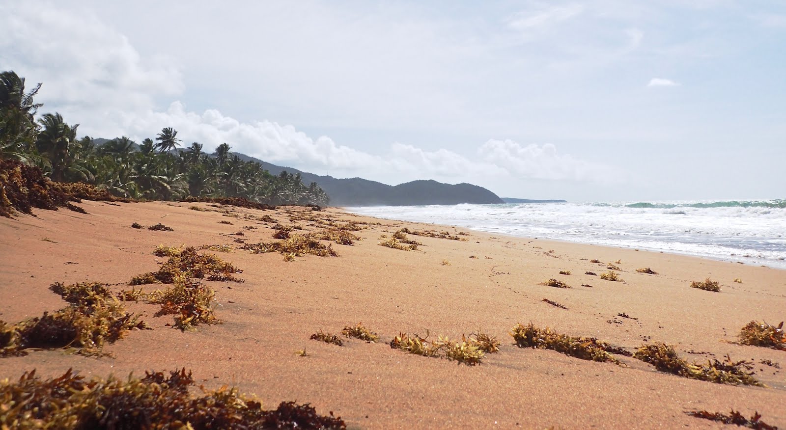
We all met up at the parking lot of Centro Vocational y Balneario Punta Guillarte, which just happens to also be our favorite little happy hour spot, Puri's Tiki bar... and caravanned down the road to the Balneario Punta Guilarte beach. Punta Guilarte is actually the point we walk to when we follow our beach to the west.
Everyone else in our group was fluent in Spanish, and the event was advertised as being in Spanish... but our wonderful leader, Wylmarie, speaks very good English, and she was happy to make sure that we got the pertinent points. It was so good for me to try to figure out what they were saying, and I really think I got the gist of it, if not the full meaning. Today's learned phrase is "Estoy cansada!" (I'm TIRED)
Balneario, which here means a beach park with public facilities... Balneario Punta Guilarte was once a very nice facility with cabanas and tables where families could come and enjoy the gentle, shallow waters in the bay. Hurricane Maria damaged all of the buildings, and only some are beginning to be restored. Families still come here, so there is some trash to be cleaned up! There's also a good bit of stuff that washes ashore, but I have to say... I was very surprised at how LITTLE trash we found!
Bruce and I walked mostly the grassy areas, while many of the others picked through the seaweed and high tide line. We had a nice, cool breeze and started picking up trash at about 9am, but that sun got warm pretty fast!
Cloud cover kept it from being TOO hot!
We made our way down the beach from the parking lot to the eastern point, then called it quits. I think we picked for about an hour and a half, maybe a little longer. It was good exercise, hauling that ever-heavier bag, bending and reaching and walking... When they called for us to return to the base, I didn't have to be told twice!
We all piled our bags around the weighting station and had some healthy snacks while we waited to hear how much trash we had collected.
We talked about the different types of trash we collected. Most of it was small pieces, caps off of water bottles and beer bottles, some glass, quite a bit of plastic straws and wrappers, some styrofoam... couple of shoes and pieces of clothing! Some items found were left over from Hurricane Maria - wires and boards... Then the usual cups, cans and water bottles. But like I said, we didn't find the beach to be too dirty, so that was encouraging!
Watching the weighting...
The grand total was 149 pounds! Not too bad for a small group! I can't tell you how good it feels to be a part of this positive action, and of this community of great folks! We're learning about our island and meeting people who care about the environment, and giving back to the people who have so warmly welcomed us to their island!
The lovely Wylmarie giving us the grand total! 149 POUNDS!
Puerto Rico is following a Federal Mandate to monitor beaches for increased levels of bacteria, and provide results to the public. These are the public beaches around the island that are being monitored and reported. This post provides a sample of what you can find on the website, and the explanation below was translated using Google Translate. You can find this, and much more information by clicking the map!
Click on the map to go to the current readings on JCA's Website
What is the Beach Monitoring and Public Notification Program?
Under the Federal "Beaches Environmental Assessment and Coastal Health Act" of 2000, the Water Quality Area of the Environmental Quality Board (JCA) implemented the Beach Monitoring and Public Notification Program. The purpose of this program is that bathers reduce the risk of developing diseases when they are exposed to using a beach that is under notice of bacteriological contamination.
What indicator is used?
The parameter used to evaluate the quality of water on beaches in bacteriological terms is enterococci. This is an indicator of the possible existence of pathogens in water. Pathogens are microorganisms that cause diseases and live in the large intestine of warm-blooded beings. The most common diseases caused by pathogens, by bathing in waters contaminated by feces, are infections of the eyes, ears, skin, diseases of the respiratory tract and the gastrointestinal tract.
The Enterococcal parameter exceeds the "Beach Action Value" applicable when:
• The result of the bacteriological analysis is greater than 70 colonies per 100 milliliters of water (colonies / 100mL).
What does the map reflect?
The beaches that appear on the map with green flag are in compliance with the "Beach Action Value" of enterococci and its use is recommended for bathers. However, if a beach has a yellow flag it means that it has exceeded the "Beach Action Value" of 70 col / 100 / mL and its use is not recommended for immersion (primary contact).
What could happen if a bather uses a beach with a yellow flag?
The beach with yellow flag is not recommended for primary contact, because there is the possibility that there are pathogenic organisms that can cause diseases in the skin, eyes, nose, throat and gastrointestinal system.
How long will this map be valid?
The results of the samplings reflected in the map will remain until the next notification.
What staff of the JCA works to provide this useful tool for the country?
The effort to create the map for the benefit of citizens and bathers arises in the Water Quality Area (ACA) of the JCA. Initially the personnel of the Water Sampling Division mobilized to 35 beaches (designated as beaches by the PR Planning Board) to take the water samples. Said samples are delivered to the Environmental Investigation Laboratory of Puerto Rico where the incubation and analysis process is carried out. Once the results are ready, the Laboratory sends them to the Division of Plans and Special Projects (DPPE) of the ACA and to the Office of Control and Quality Assurance of the JCA (OCCC). Once the OCCC verifies the certainty of the quality of the results, the DPPE carries out the evaluation of the water quality of the beaches and sends the information to the Press Office, the Office of Systems and Regional Offices of the JCA. The Information Systems Office of the public agency provides the data and the corresponding public notification on the agency's website, at the same time the Agency's Communications and Education Manager issues a press release to the media (television, radio and written press) indicating if the beaches are suitable for bathers. The DPPE sends the information of the evaluation of the quality of the water of the beaches and the results of the samplings to the administrators of the beaches. Among the administrators are; agencies such as the National Parks Company of PR, the Department of Natural and Environmental Resources, Municipalities and private entities such as Hotels, Beach Apartments, among others.
What other recommendations does the JCA offer regarding the use of beaches in the country?
It is recommended that bathers take into consideration that after continuous rain events should not have contact with bodies of water until twenty-four (24) hours after they have finished, since they are more likely to acquire infectious diseases caused by these pathogenic organisms. It is also necessary to point out that bathers must move away from the mouths of the bodies of water and the pipes used for the discharge of rainwater to the beach.
We urge citizens to follow our recommendation to avoid immersion in beaches that exceed the parameters of bacteriology and therefore have a yellow flag. We must point out that the Environmental Quality Board issues this notification to the country as a highly useful public service. It is the beach managers who, once notified, have to their credit how they physically notify the public about the information generated by our agency.
Peering through the vine-laden gates of Hacienda San Isidoro in Patillas.
Maybe it's the new vitamins... or maybe it's just seeing so many places to visit on the Google Map! Whatever it is, we seem to be making up for lost time after spending so many days working on getting the boat cleaned up and ready for sale! All work and no play makes Dos Libras in Puerto Rico VERY CRANKY!
So, play it is! Thanks to Facebook, I get information about the many festivals that are held by the municipalities across the island. I take special note of those within a short distance from us. I put them on our calendar in case I wake up in the morning and get a wild hair! Today's little festival was Festival de la Launcha Planúa in the seaside town of Humacao on the Island's east coast. But there are LOTS of interesting places to stop along the way... so let me show you what we found!
Hacienda San Isidoro: This old plantation house has caught our eye many times as we've sped past on our way to someplace else... Today we stopped and tramped through the grass outside the gate trying to get a better look. The mansion is just amazing. It is ornate and HUGE and it looks to be in relatively good shape as ruins go.
There isn't much information that I can find on the internet about this place. All I know is that it was an old sugar mill plantation and now it is owned by the Municipality of Patillas, PR. There seems to be some evidence of recent activity in that it is well kept and the grounds are clean and mowed. There might be some connection to horses but I wasn't able to get very far on that. Maybe some of you know!
You can get just enough of a view to entice you more! I want IN!
Next door there is a ruin of an old sugar mill.
Just across the road is another old building in ruins. Not sure if it's connected but I assume it is.
I took a peek inside and it's pretty much taken over by vegetation.
Highway 3 winds through the hills along the southeast coast. We stopped for a view of our next destination from afar!
Getting closer!
Remember this is a beach-hopping excursion! We followed the coast road and stayed off the highways to see the views. We didn't want to miss any little out-of-the-way places along the way!
The first little beach on our stop-list was in the municipality of Maunabo. It was very easy to get to, and had nice infrastructure for trash and recycling. The beach was picture perfect and is reported to be home to turtles for nesting, so be careful! The palms line the sandy beach and there is even a layer of black sand at the top of the tide line!
There wasn't a crowd so far by late Saturday morning, but I'm sure this one is popular! The shade alone earns it a place on our list of places to revisit!
Lots of shady parking!
Gotta stop for shots of strange stuff we see along the way!
Faro Punta Tuna: The Punta Tuna Lighthouse sits on a rocky point that juts into the Caribbean Sea along the curving southeast coast. First lit in 1893, the structure has been damaged by hurricanes and is currently being restored by the Municipality of Maunabo. The drive along the coast road to get there is an attraction in itself, and then there is the beach below the lighthouse! Jackpot!
A resident was harvesting Breadfruit!
The road that ultimately leads to the lighthouse is narrow and lined with modest homes. The lighthouse grounds start at the cul-de-sac at the end of the street and there is uneven, paved parking for only maybe half a dozen cars. I think the views are best in the morning and maybe the traffic is lighter too. We got there before 11am and there were several cars, but room for us. And the Limber stand was just opening up!
The Limber stand sells many flavours of frozen fruity juice cups! Get the Coco!
Looking back toward Playa Los Bohios!
The obligatory selfie
There were some busted window panes so we got glimpses of the inside.
A small museum I don't remember from our last visit was opening up.
It has some interesting things, mostly pieces and bits found nearby.
You can't have too many coastal beach photos, can you?
There is an easy trail leading through the trees and down to the beach.
Sargassum Seaweed is a problem again this year.
See how Bruce is trying to get in the Spirit!
Continuing on... more interesting things to see along the way to the next stop!
The Flamboyants are in full bloom! You can see the runoff from yesterdays rain in the mountains!
Playa Lucia: Lucia Beach in Yabacoa, is on the LONG stretch of eastern coastline and has more palm trees in one place than I've ever seen before in my life! There is a small hotel at the southern end of the beach, and broken cement bike paths and sandy pathways wind their way through the palms to the many picnic shelters left barely standing by Hurricane Maria. There is a public building that looks to have been maybe a restaurant, but it's difficult to tell in its current state of ruin. Graffiti is everywhere on the building, but the only thing that marred the beauty of the beach is the increasing amount of seaweed that is washing ashore! This place used to be awesome! I hope the money to fix it is found eventually!
The buildings lie in ruins like so many others on the island... still it's a beaut
Dulce Artes: This day just keeps getting better and better! The Limbers were creamy and delicious, but we were still getting really hungry by this time. Just down the road we found a place that looked good... and we were right! Panaderia & Reposteria Deli - Dulce Artes wasn't even on the Google Map... until now! It's just the cutest little place and the Tripleta (we're becoming experts) was delicious! They also have a nice assortment of pastries and desserts. We were good. We only chose one each to take away! This one is on the LIST!
Tripleta sandwich. Three kinds of meat, sauce and salad. Yummy!
Yabucoa Harbor Boulevard: From Lucia beach, we could have just gone right on down the sandy highway, but even with all wheel drive, I was not brave enough to try it, so we went the long way around (and found that awesome bakery). At the northern end of Lucia Beach, where the entrance to the industrial ship channel slices the beach in two, there can be found a nice little recreational area. But the first thing that caught my eye was these two palm trees with multiple hammocks lined up, and Up, and UP between them!
The locals were happy to tell us about this place and one lady had a photo on her phone that showed these trees with twenty two hammock strung between them. There were kids swinging in most of these and I just marvelled at how they must have made it up all that way! I love Puerto Ricans!
Very nice and newly painted!
There is a stage area with plenty of room for chairs or dancing, kiosks for food sellers line the walk and there is a nice fountain for kids to play in, although it wasn't turned on today. There would be music here tomorrow, but it's a little far for us to come back again so soon.
Water spouts up from the pipes providing a cool place for kids of all ages to play out here on this breezy point!
Tankers in port
The channel that leads out to the Caribbean Sea is industrial and mostly oil tankers come here to bring oil for the local refinery. There is a sea of oil storage tanks nearby. We could see two tankers in port presently... but the best thing we saw, was this huge channel marker right up close and personal! WOW I had no idea they were that big! They don't look it when they're in the water! I thought it would make a nice decoration for our poolside, but Bruce couldn't get it into the car!
Honey... If you REALLY loved me, you would get this for me!
Well he tried. Probably against the law to take it anyway...
Last stop, Punta Santiago in Humacao
Festival de la Lancha Planúa in Humacao: Finally we arrived to the place that was the actual destination for today's outing. So many festivals, so little time! By mid afternoon we were beginning to fade and it was getting HOT! I looked at Bruce and could tell that he really wanted to turn toward home, but when I asked him, he agreed that we had come all of this way, we might as well take a stroll through the place.
Doesn't he look thrilled???
The festival grounds were alive with colorful carnival rides and vendors, and there was a tent providing blessed shade for the artisans plying their wares. But the first thing I did was to drag Bruce to the ticket booth. I wanted to ride the carnival rides! I picked out two and we bought the tickets. $1 each. There wasn't much of a crowd in the heat of the afternoon, so we didn't have to wait to get on. In hindsight, I should have let Bruce sit on the inside so that he would be pushed into me from the centrifugal force generated by the ride. As it was, he probably won't walk right for a while after I squished his skinny butt for the duration of the very long ride. I thought it was a hoot! I think Bruce has a different opinion...
Trying to get the blood flowing through our bodies once more, we walked out to the Punta Santiago Pier. It is terribly torn up from Maria. We walked along the beach, the smell of drying seaweed strong in the air.
Click "When we were here in 2016" to the right of this photo for that post
Looking out at nearby Santiago Island - known to the sailing community as Monkey Island. We couldn't believe our eyes when we saw how bare it was! Two years after the hurricane and the place looks like a brown sand dune with a few spindly twigs poking up. When we were here in 2016, it was a lush forrest with tall trees for the monkeys that live there to swing in, and to provide them with shelter from the beating sun. How can they live there now??? I hope the researchers are taking good care of them.
After checking out the beach, we drifted to the cool shade beneath the artisan tent. I bought a little treasure to hang in our patio. It's fun to be able to buy souvenirs again after living so long on the boat with limited space! I resisted so many other things though, can't be greedy! We picked up a huge Lemonada at one of the stands and suddenly we were done. Our energy just drained out of us and we were ready to hit the highway toward home!
But we had two more ride tickets! On our way to the car, we found a mamma with two young boys and I gave the tickets to her. The transformation in that little boy when he realized that he was going to get another ride... well, it was worth the price of admission! We watched as he got on the ride and his smile just made our day. What a perfect ending to a wonderful day. Every time we leave our condo, we fall more and more in love with this island and her people. Come to Puerto Rico... and we'll take you Beach Hopping!
 Since Bruce and I don't have jobs, (not that we have a whole lot of FREE time!) we have been looking for a way to meet people while helping our new community in some meaningful way. We lucked onto this awesome group, Para la Naturaleza, who does educational tours and organises work projects and today, we went to our first event! It was literally in our back yard... OK, well maybe just around the corner!
  We all met up at the parking lot of Centro Vocational y Balneario Punta Guillarte, which just happens to also be our favorite little happy hour spot, Puri's Tiki bar... and caravanned down the road to the Balneario Punta Guilarte beach. Punta Guilarte is actually the point we walk to when we follow our beach to the west.
  Bruce and I walked mostly the grassy areas, while many of the others picked through the seaweed and high tide line. We had a nice, cool breeze and started picking up trash at about 9am, but that sun got warm pretty fast!
 We made our way down the beach from the parking lot to the eastern point, then called it quits. I think we picked for about an hour and a half, maybe a little longer. It was good exercise, hauling that ever-heavier bag, bending and reaching and walking... When they called for us to return to the base, I didn't have to be told twice!
  We all piled our bags around the weighting station and had some healthy snacks while we waited to hear how much trash we had collected.